Crowdsourced bike-safety insights.
Video data from real rides becomes actionable insight for the cities and advocacy organizations working to make streets safer.
Three ways riders generate data
Hazard Reporting
Seamless 311 integration — Reports can go directly into the city’s 311 system.
No-stop reporting — Riders record their full ride and submit reports post-ride, when it’s safe to do so.
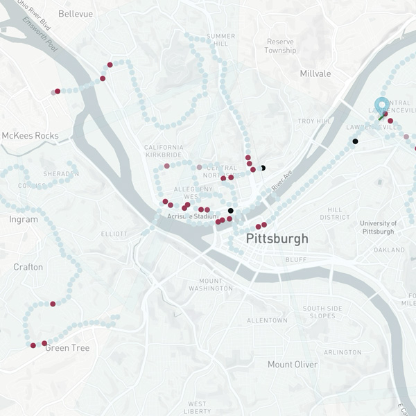
Identify patterns in close calls — Close-call data is denser than crash data — and comes with video.
Automated Insights
AI-powered ride analysis — Smartphone sensor data is analyzed for swerves and hard braking.
Citywide rough-surface detection — Find potholes and rough patches that actually affected cyclists.
Data visualization — Heatmaps of problem areas, with photo and video evidence.
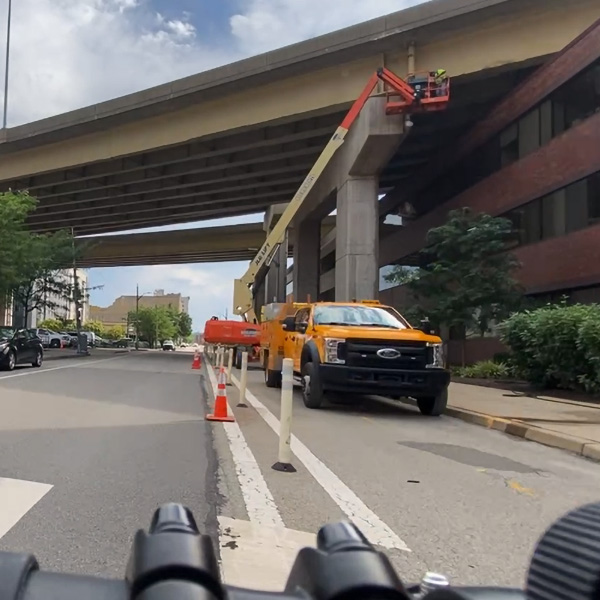
Bike Lane Closure Inspection
Video audits for detours — Riders share footage of construction zones impacting the bike network.
Find & fine unpermitted closures — Inspectors check permit compliance remotely — missing detours or flaggers.
Ensure compliance — Issue fines or schedule inspections based on video evidence.
From handlebars to city hall
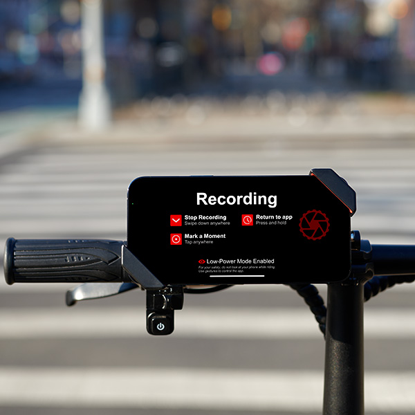
Recorded videos
Riders record their ride with the dashcam.bike app and our low-cost phone mount.
Reported hazards
Manual hazard reports plus automated road-quality and bike-lane-closure reporting.
Safety insights
We analyze and aggregate the data to find hotspots of likely crashes or blocked lanes.
How it helps cities and advocates
Make your city safer for bicyclists
Let’s talk about how our crowdsourced data platform can improve your city.
Bike advocates: want us to reach out to your city? Join the waitlist.